Note: This quick start guide is meant for WingtraRAY drone users. If you have a WingtraOne GEN II, see the relevant guide here
Product information
Content table
- 1. First steps with WingtraRAY
- 2. Before you go into the field
- 3. Set up your flight plan
- 4. Field set-up (Wingtra GROUND)
1. First steps with WingtraRAY
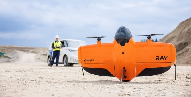
Welcome
The Wingtra team from Zurich and around the globe is excited to welcome you as a valuable customer. Thank you for your trust, and you can be sure that we will do our best to support you with your mapping projects.
Know the rules before you fly
The regulatory environment for drone operations is constantly changing. For the most up-to-date information go to: knowledge.wingtra.com/regulations.
Learn more at knowledge.wingtra.com
Give feedback at feedback.wingtra.com
Open a ticket at knowledge.wingtra.com/kb-tickets/new
Get help by writing to support@wingtra.com
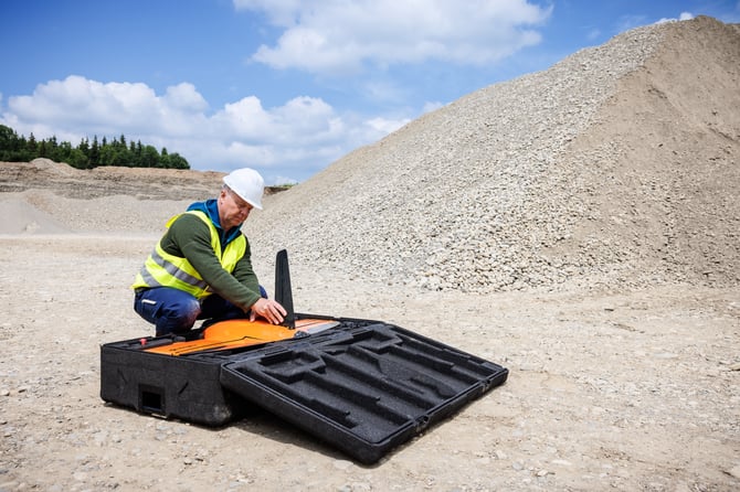
Unbox
Make sure you received all items from the WingtraRAY bundle. Keep the original packaging, in case of an incident, Wingtra Support might request a return of the equipment to Wingtra's office.
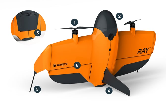
Drone
- Propellers/drivetrains
- Nose cone
- Parachute cover
- Fin (landing gear)
- Winglets (landing gear)
- Flaps
- Payload mount
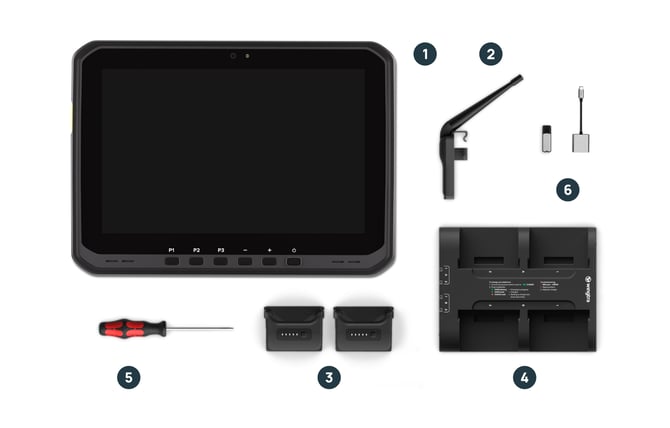
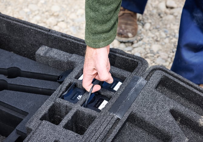
Included in the bundle
- Tablet TabActive 5 Pro
- 1 x Telemetry module (2.4 Ghz)
- 2 x batteries (one set, two batteries are required per flight)
- 1 x battery charger incl charging dock & cables
- 1 x Screwdriver (T10 Torx) for drivetrain replacement, parachute installation and repairs
- 1 x USB-C/SD Adapter
- 1 x Drone hardcase
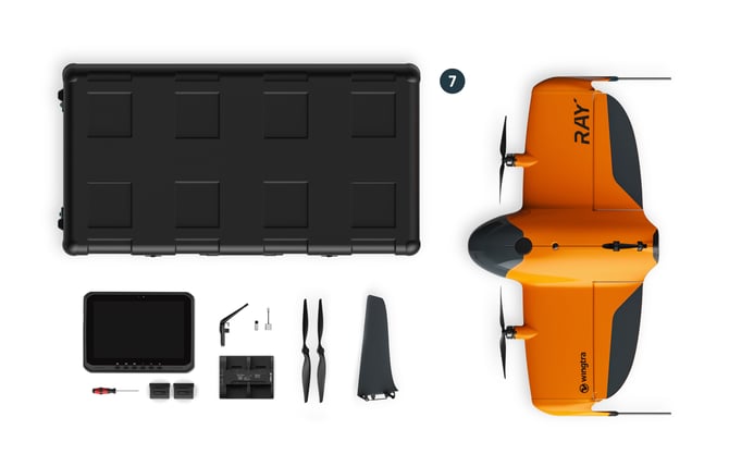
Hardcase layout
-png.png?width=670&height=613&name=image%20(6)-png.png)
Note: Individual items carried in the case "without" a drone inserted can get damaged. The drone is needed to keep items in place.
Create an account on cloud.wingtra.com and activate your drone
- Open any browser on your computer or on the Wingtra tablet
- Navigate to cloud.wingtra.com and click on “create new account” (skip if you already have an account)
- Follow the set up instructions. You get the “invitation code” from your local Wingtra partner (skip if you already have an account)
- Open the App “Wingtra” on the tablet and log in with your account. Ensure you have internet connection.
- Update the App if you are prompted to do so
- Connect the telemetry to the tablet, power the drone, and your drone gets activated automatically
- Navigate to the “fleet” tab in the Wingtra app and verify that your drone is listed
Note: Your tablet should ship with an app called "Wingtra" and not with the legacy app "WingtraPilot".
- If you see an app "WingtraPilot", uninstall it.
- If you do not see an app "Wingtra": Open the browser, navigate to cloud.wingtra.com, log in, and download the Android app under your account settings (icon top right).
Note: You cannot operate your drone until it has been set up by following the steps above.
If you are having difficulty with creating an account or setting up your drone, please use the following link to find out more information: https://knowledge.wingtra.com/en/drone-activation-for-customers
Update the software
Connect your tablet to the internet (WiFi). Update Wingtra App if you receive a pop-up telling you that there is a new software update available. Skip this step if there is no pop-up.
- Wingtra App will tell you if a new release is available for your drone
- Follow the in-app guidance to update the drone
Learn more about the update process at
Get logs for support
In case you need to share flight logs for support, follow the following steps
- Open the Wingtra App, connect the telemetry and power the drone.
- Navigate to the fleet tab, select your drone ID and click on it.
- Click on “system report” and follow the in-app guidance.
-
Power off the Wingtra drone and get the SD card out of the drone.
- The transferred flight logs are stored on the SD card in the as a .tar archive. Upload the .tar file using our WeTransfer Portal. You can ignore the other folders.
- Please provide the date and time where you had the issue to help us identify the correct logs from the archive.
Note: In order to prevent unauthorized access to your tablet set a lock screen under Settings > Lock Screen.
2. Before you go into the field with WingtraRAY
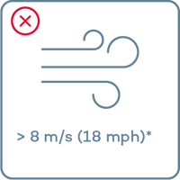
Do not fly in the following conditions
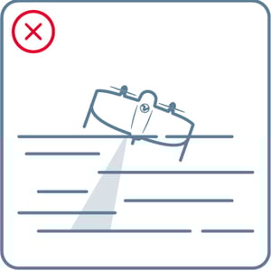
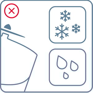
- Fog
- Snow or rain
- Strong continuous winds*
- Extreme temperatures
- High altitude **
Use return to home (RTH) function if conditions change while flying.
*8 m/s (18 mph) continuous wind speed measured on ground corresponds to approx 12 m/s (27 mph) continuous wind on 120 m (400 ft)
** With high altitude drivetrains up to 4800 m (15’700 ft) AMSL
Download offline maps
If you do not have an internet connection in the field, you can download a map beforehand. To do so:
- Go to our “Sites”
- Click on the three dots on a site card
- Select “Make site available offline”. This will download the terrain data of your site and all the flights.
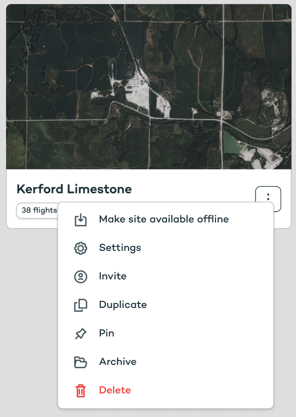
Note: If you imported custom terrain to a flight it may show a warning and you need to confirm to download it.
Charge your batteries
- Ensure the physical switch is set to “charge”
- Plug in the batteries
- Green blinking → charging in progress
- Green solid → Charged
- Orange solid → waiting to charge next (only 2 at as time)
- Red solid -> Error (reseat battery, restart charger)
- Purple solid -> Battery too hot or too cold for charging
- Connect the charger output cables to the AC/DC converter brick and power it from the wall
- Once the batteries are charged, the charger will continuously top them up. Do not leave the batteries in the charger without having power from the wall, as this may discharge them.
Note:
- Always use batteries in pairs
WingtraRay Li-Ion batteries should aways be used in pairs. This results in the batteries aging at the same rate and minimizes the chance of the drone triggering RTH due to battery health differences. Check laser markings on the front of the battery: a pair is indicated by two batteries "A" and "B" sharing the same sequence number ("1234A" and "1234B" ). - Do not keep batteries in the drone
Even if powered off, the batteries can deep discharge if left in the drone for a prolonged period of time.
Trouble shooting when getting an error (red solid)
- Replug battery
- Repower charger
- Email support@wingtra.com if it doesn't solve the issue
Keep your batteries healthy

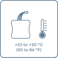
- Do not expose them to sun
- Before flying, keep them at a moderate temperature
- For longer storage, keep them at room temperature. Use the charger’s “storage” mode to bring the state of charge to the ideal storage level
Battery & charging recommendations
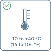
- Flight performance drops when batteries are too cold or hot. WingtraRAY prevents takeoff if battery temperature is below 10°C or above 45°C. Avoid exposing batteries to warm environments and direct sunlight (use the nose cone to provide shade). Keep in mind: powering the drone for long periods of time before takeoff heats the batteries.
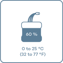
- For longest life, store batteries between –20°C and +25°C; high temps shorten longevity.
- High humidity also reduces battery lifespan—keep below 75% RH.
- High state-of-charge during storage reduces battery life. If not flying within 7 days, use the charger’s “storage mode” to set ideal charge.
- Don’t leave batteries on a powered charger long-term—this keeps them topped up but shortens life.
- Don’t leave batteries on an unpowered charger—it will discharge them and cause permanent damage.
- Don’t leave batteries connected to the drone when not in use—over-discharge can cause irreversible damage.
- After 3+ months of storage, run an activation cycle to prevent damage and improve SOC accuracy: fully charge, then discharge via “storage mode” using the WingtraRAY charger.
Install the parachute add-on (optional)
Note: refer to the following article to install the parachute add-on in WingtraRAY: Wingtra Parachute Guide
3. Set up your digital site and create a flight plan
Set up a digital site
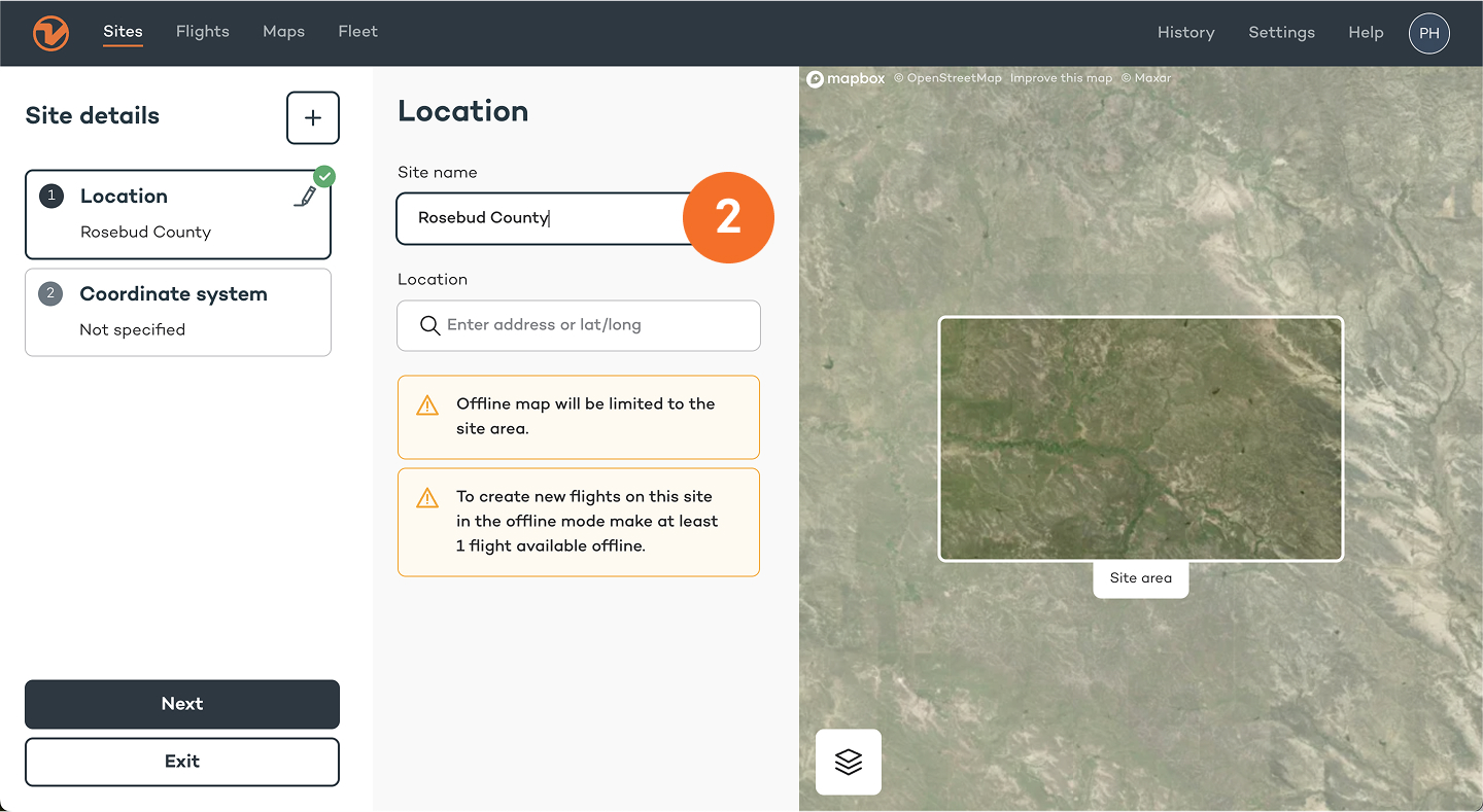
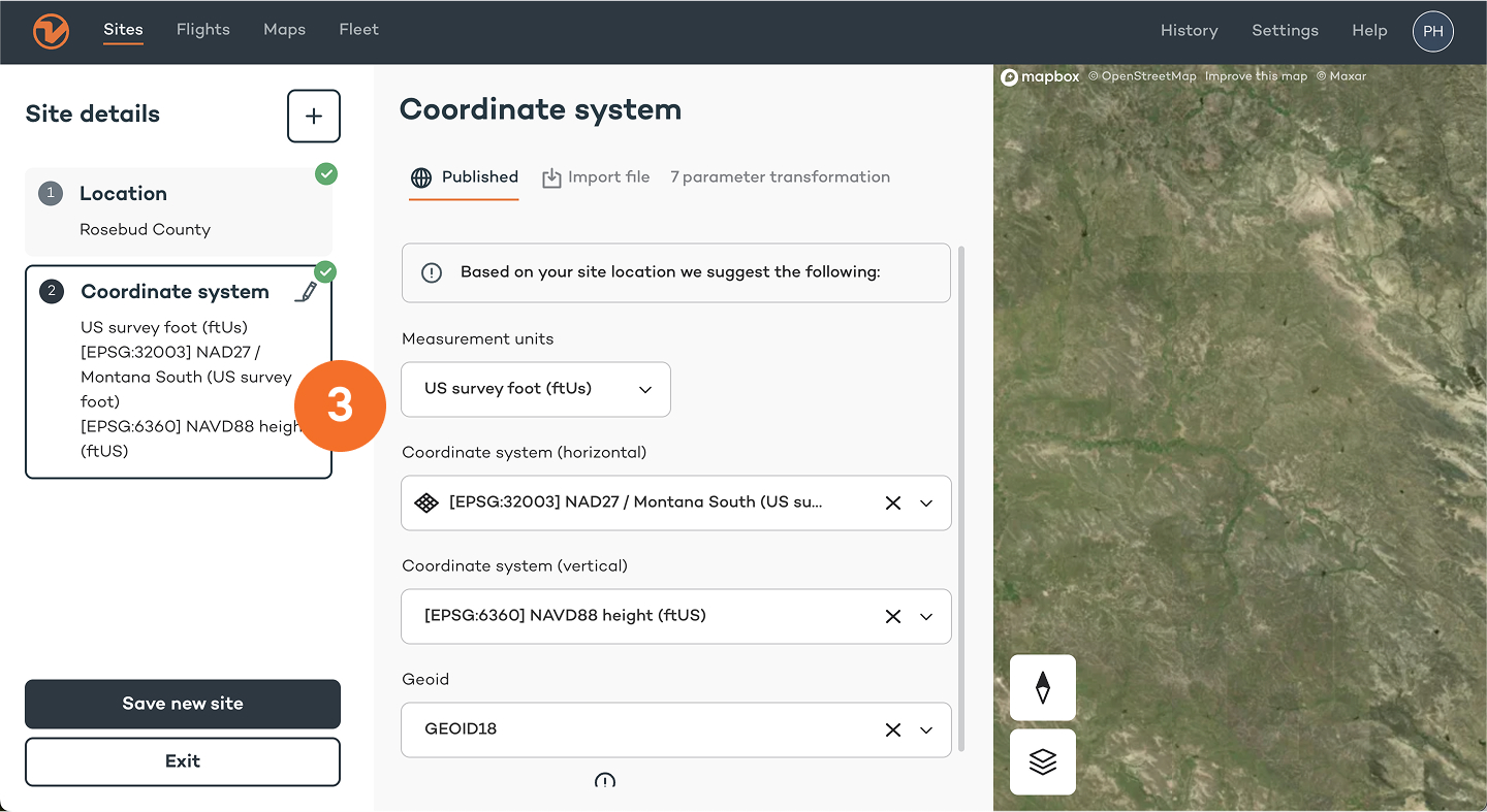
1. Open the Wingtra App, in the “Sites” tab select “New Site”.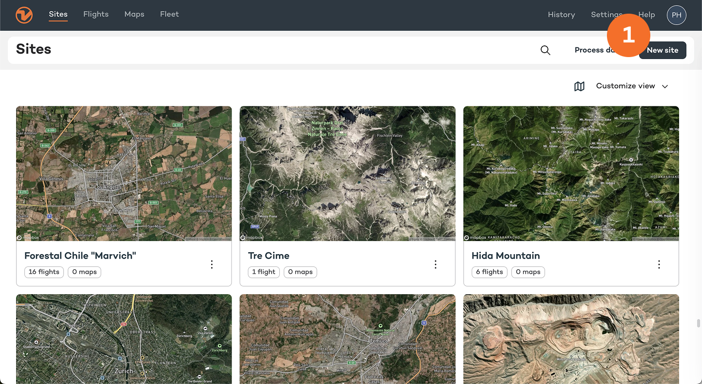
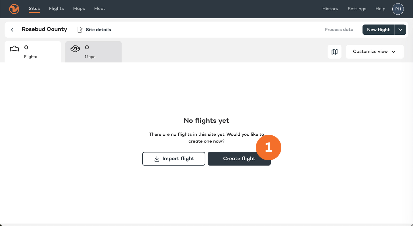
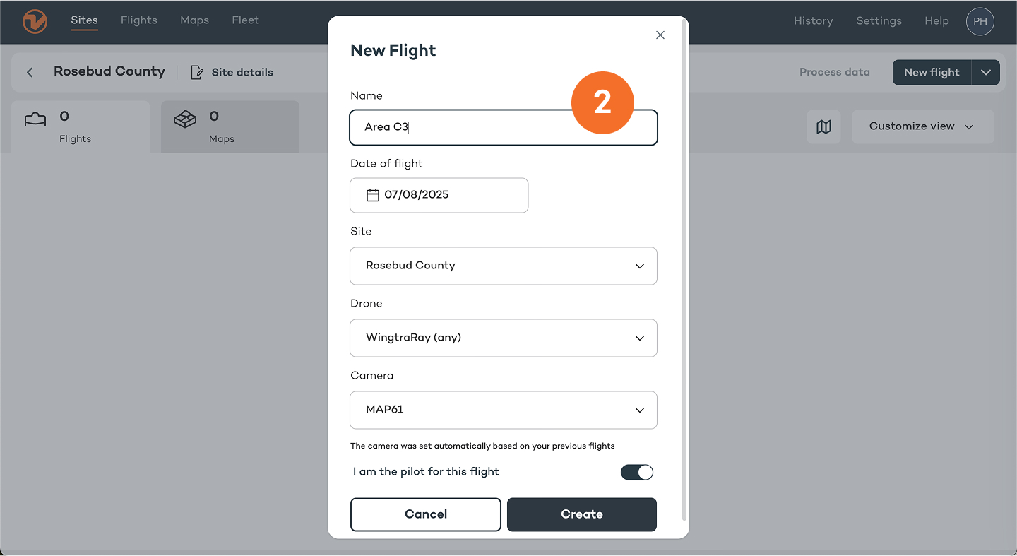
Create a flight plan
- Create a new flight on your site.
You can also plan your flights in WingtraCLOUD on your desktop computer
Learn more: https://knowledge.wingtra.com/en/wingtracloud
Create a home point and set the transition height
1. Tap the "Plan" and then "Home" icon to create a home point at the planned take-off location; it will be updated once connected to the drone
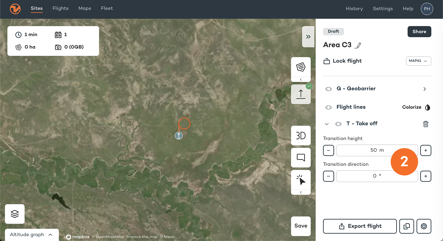
Home point and transition height explained
- Home point is the place where your drone takes off and lands
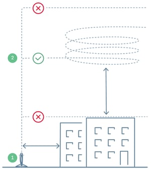
- Transition height is where your drone transitions into a forward flight mode
Always set the transition height at least 20 m (65 ft) above obstacles, but not too high! Increased transition height reduces flight time.
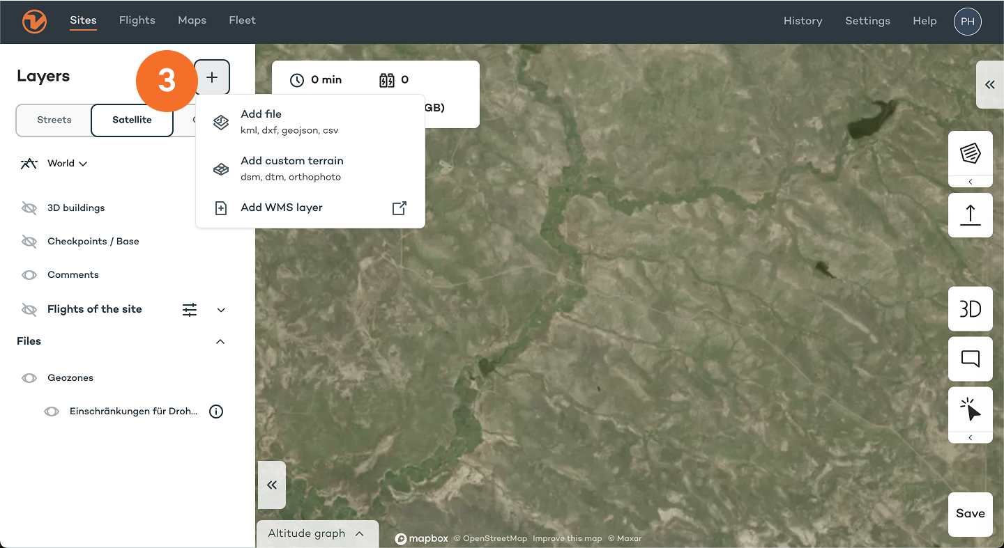
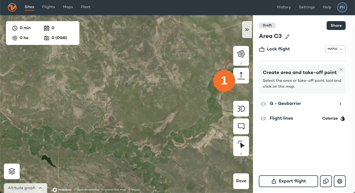
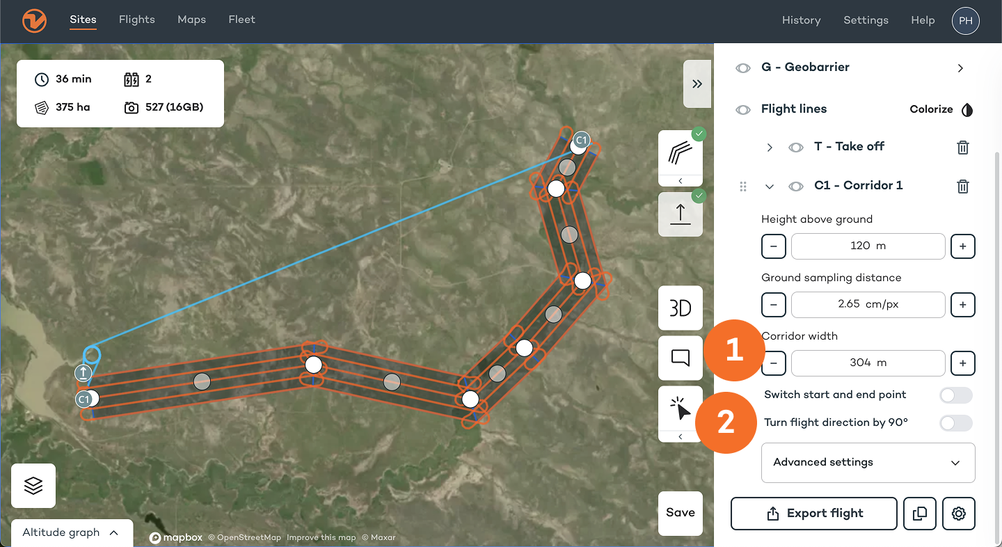
Create area(s) or corridor(s)
An "area" or a "corridor" is where you want your drone to fly and capture the data.
1. Add one or several areas by clicking on the "Area" tool and drawing on the map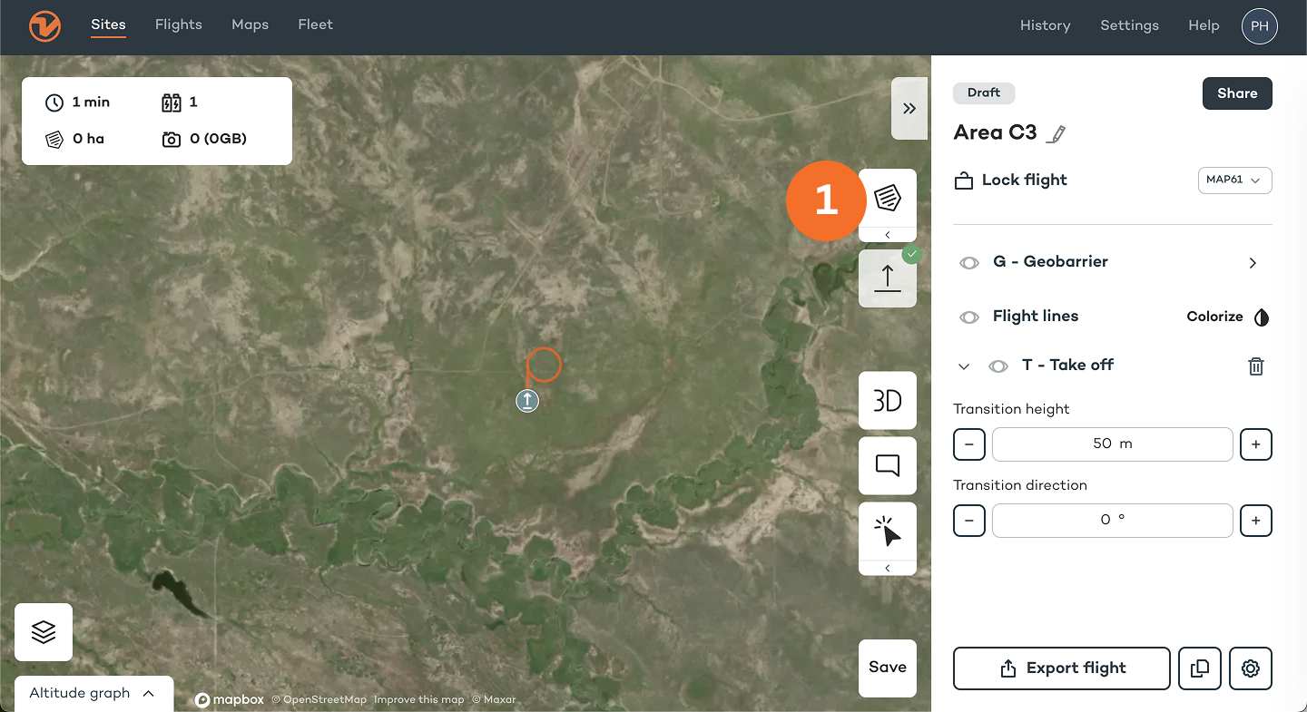
Note: When necessary, loiter waypoints are automatically inserted between two areas; additional waypoints can be inserted manually to ensure safe flight paths between areas and back to the home point
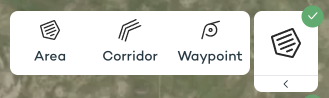
3. Move the corners until you have outlined the area(s); you can also move the position of the area(s) by moving the A1/A2 bubble in the middle
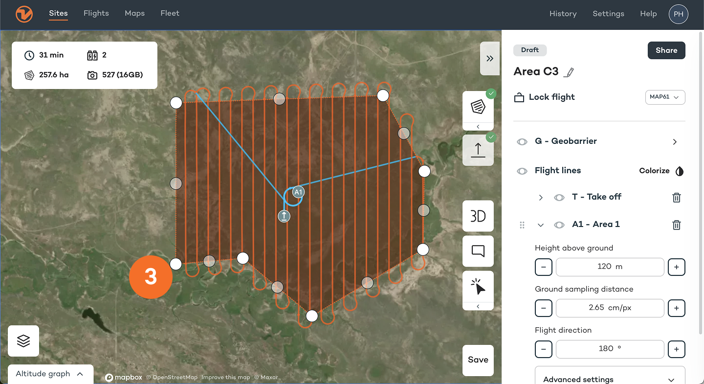
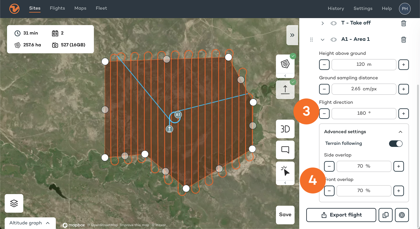
Adjust parameters
Important
- When using "terrain following", make sure the box is ticked, especially when flying over hilly terrain
- "Height above ground" and "Ground sampling distance": define at what height your drone should fly to get the required GSD
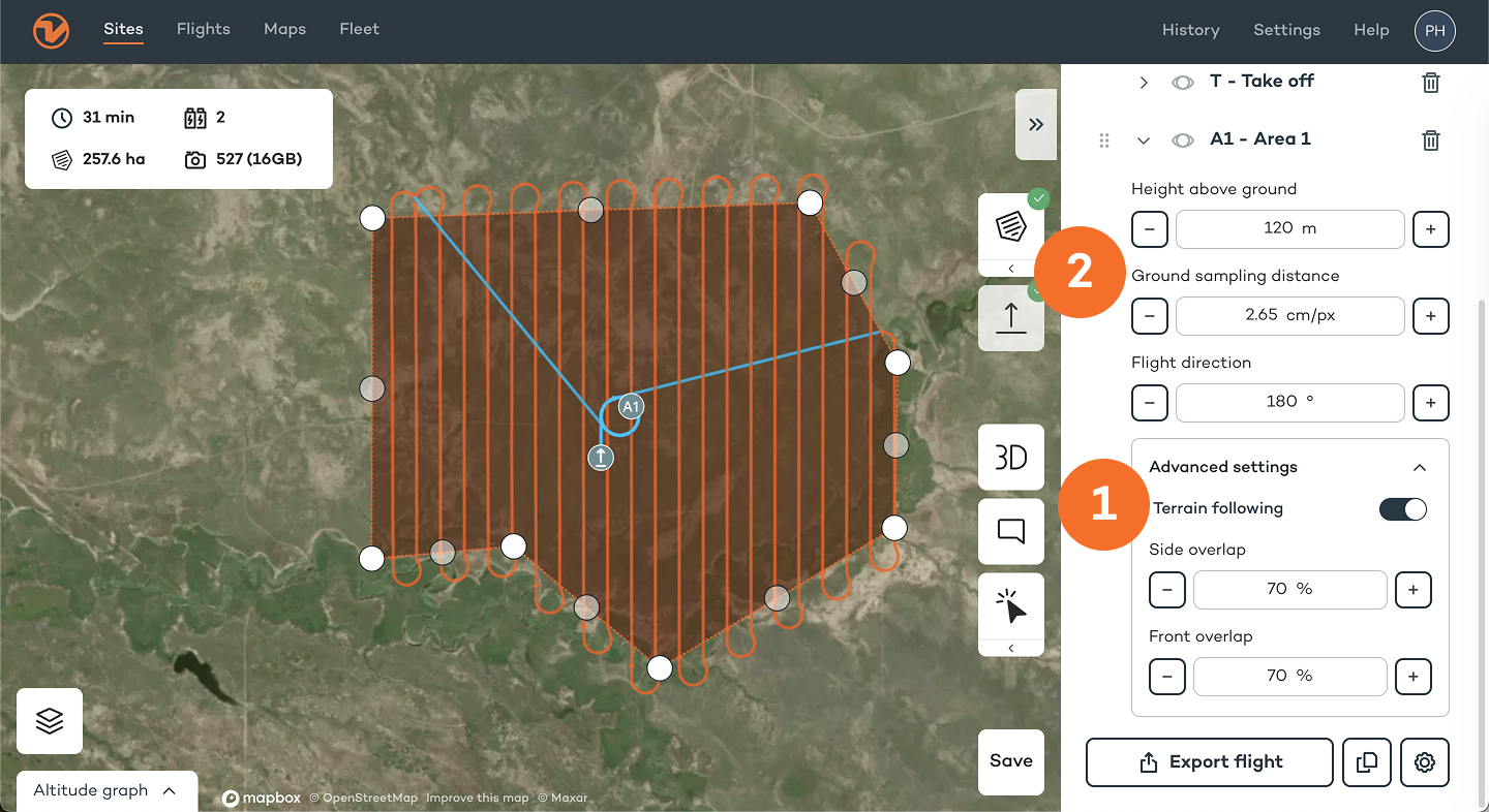
Optional
- "Flight direction": set the angle of your flight direction, if possible perpendicular to the wind direction
- "Side overlap" and "front overlap" is based on percentage, and >60% is recommended (consult knowledge.wingtra.com for more detailed recommendations)
Optional "corridor" parameters
- Define the corridor width
- Switch start and end point and turn flight direction 90°, e.g., if the terrain is steep
Adjust safety parameters
Under the “Geobarrier” tab you can find safety parameters and geobarrier settings
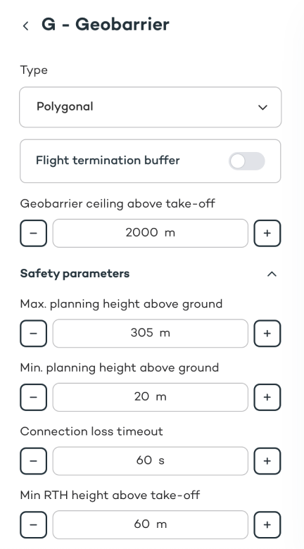
Min. and max. planning height above ground
These parameters define the minimum and maximum height above ground for the flight of the drone.
If the drone cannot fly within these parameters, take off will be denied.
Sections where these safety parameters cannot be respected will be highlighted as errors.
Recommended minimum height is 10 m (30 ft) higher than the tallest object in your area.
Connection loss timeout
This parameter defines the maximum time a telemetry connection can be lost until a flight is aborted and Return to Home (RTH) is triggered.
Increase this value if you are flying beyond visual line of sight (BVLOS) or if you are flying in environments where the telemetry connection cannot be maintained (e.g. due to the topography of the area of operation).
The drone will still collect data, if the telemetry connection is lost during the flight. However, the user interface in Wingtra App will not be updated in real time.
Safe Return To Home (RTH)
The drone will fly home on a safe path. This may not be a direct path to home, depending on the planned mission or topography of the area of operation.
Safe RTH is triggered if:
- The drone flies beyond your geobarrier
- The connection between operator and drone is lost
- Battery gets low
- It detects a front-facing static obstacle that is on its path
Adjust geobarrier
Geobarrier type: Circle
This type of geobarrier confines the drone's flight area to a circle with the home point at the center. If the drone crosses this geobarrier, the Return to Home command is triggered automatically.
The dimension of this geobarrier type may be adjusted with the radius, measuring the distance from the home point to the geobarrier.

Geobarrier type: Polygon
This type of geobarrier confines the drone's flight area to a polygon shape. This shape may be modified by moving, adding or removing corner points.
If the drone should cross this geobarrier, the Return to Home command is triggered automatically.

3. Field set-up (WingtraGROUND)
Refer to the following article to set up WingtraGROUND: https://knowledge.wingtra.com/en/wingtraground
4. Prepare for take-off
Set up your drone
First time set-up.
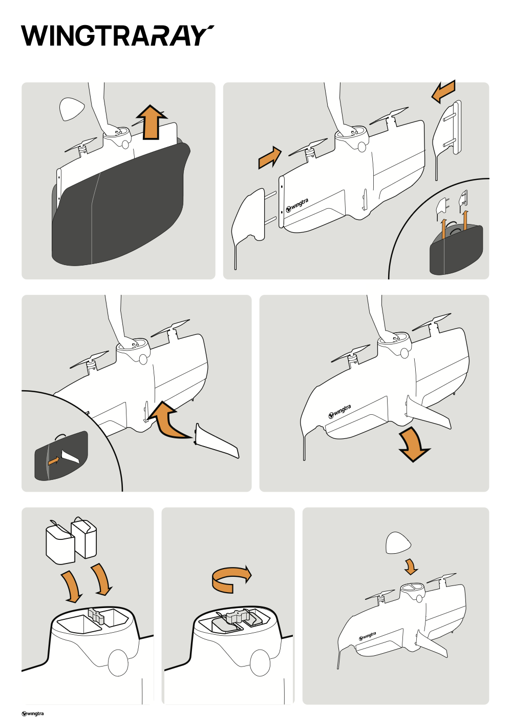
- With the drone lying flat in the box, insert the fin (landing gear) into the drone by sliding it in with an upward motion until you hear a click.
- Insert the winglets by sliding them in – make sure to keep the inserts perpendicular to the wing.
- With the nose off, grab the drone via the handle in the battery compartment and set it on the ground.
- Always use batteries in pairs
WingtraRay Li-Ion batteries should aways be used in pairs. This results in the batteries aging at the same rate and minimizes the chance of the drone triggering RTH due to battery health differences. Check laser markings on the top of the battery: a pair is indicated by two batteries "A" and "B" sharing the same sequence number ("1234A" and "1234B" )..png?width=392&height=258&name=image%20(33).png)
Very early production series batteries omitted the laser marking. We encourage the user to label/mark batteries in a way that enables them to keep them paired nonetheless.
- Insert both batteries with the handles facing inwards, and lock them in by turning the twist latch perpendicular.
- Power on the drone by pressing and holding the power button until you hear the power on sound, and put the nose on – simply put it in place, it holds with magnets.
If you are equipped with a hardcase, you only have to remove the fin and the nose to put your drone away.
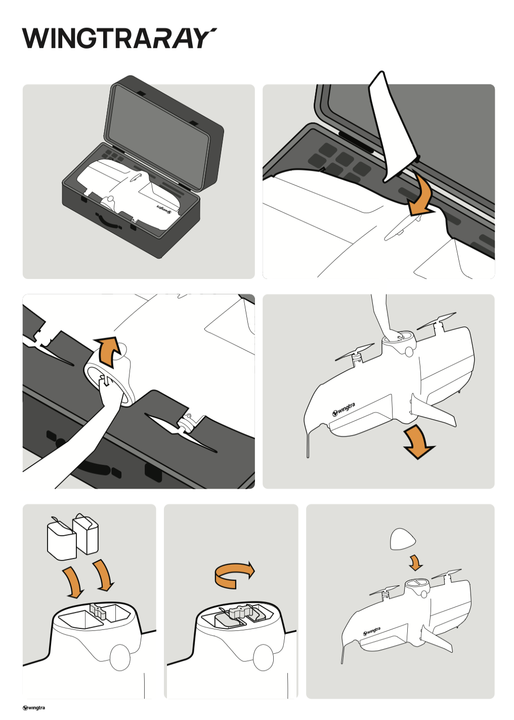
If you are using the drone bag, both the winglets, as well as the fin have to be removed for transport.
Insert your payload
Insert the sensor with its WingtraRAY mount in the drone by aligning the bottom of the mount with the bottom of the payload slot in the drone, then press the top of the mount shut and secure it with the latch at the top. To remove or switch the payloads, simply unlock the latch and take the mount out – no tools needed.
Assemble your ground station
Ground stations are not interchangeable between drones. Make sure that the drone ID matches the ID of the ground station.
The telemetry connection between drone and tablet operates on 2.4016 to 2.4776 GHz (EIRP: 19,8 dBm)."
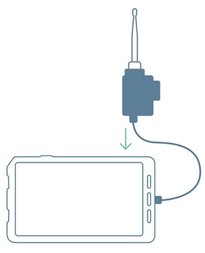
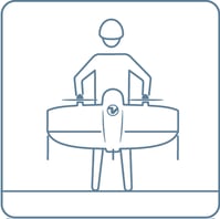
Measure the wind speed
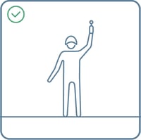
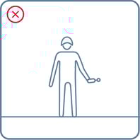
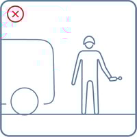
Use the wind measurement tool to measure the wind speed.
Don't measure the wind speed while standing behind big objects, e.g., buildings or trees. Raise the tool above your head to get the most accurate results.
Drone tipping expectations
In calm conditions, WingtraRAY lands smoothly on its tail. In windy conditions, the aircraft can tip over upon landing. Generally this is not a problem and damages rarely occur.
|
Measured on ground* |
Surface wind** |
Tipping expectations |
|
0-5 m/s (0-11 mph) |
0-7 m/s (0-16 mph) |
Tippings rarely occur |
|
5-8 m/s (11-18 mph) |
7-10 m/s (16-22 mph) |
Tippings can occur |
|
>8 m/s (>18 mph) |
>10 m/s (>22 mph) |
Not recommended to fly |
* As measured with the wind measurement tool from the pilot box—approx 2 m (7 ft) above the ground
** As referenced in most weather forecasts—approx 10-20 m (33-66 ft) above the ground
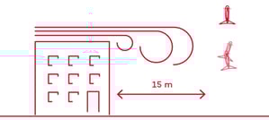
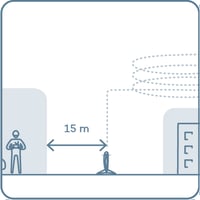
Avoid obstacles
Be aware that the obstacle clearance zone should correspond to the wind conditions. The stronger the wind, the farther from obstacles the drone should be.
Distance to objects in different wind conditions:
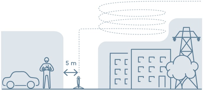
< 5 m/s (< 11 mph) continuous wind speed
> 5 m/s (> 11 mph) continuous wind speed
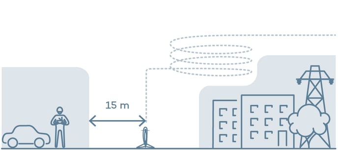

Generally, it is recommended to fly in open, obstacle-free areas.
When not keeping the recommended distance from objects, you risk crashing the drone because of drift or turbulence.
Turbulence occurs close to tall buildings, cliffs, mountains and valleys.
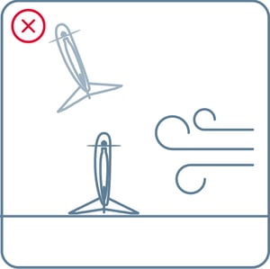
Take-off position in wind
When placing the drone for take-off, make sure that it is positioned parallel to the wind direction.
Parallel to wind
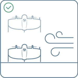
Perpendicular to wind
Prepare for take-off
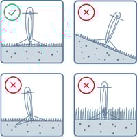
- If not already mounted, insert the fin at the back of the drone by sliding it with an upwards motion until you hear a click. Holding battery handles or the motors, place the drone on the take-off point
- Make sure the take-off point is a safe distance from people and obstacles
- Place it on even ground, making sure it doesn't sink into mud and that the grass surrounding it is not too high
Go through checklist and take off
- Select the checklist
- Follow the instructions
- Once all the checklist items are green, press the button to take off
5. During the flight
Stay alert
Observe your airspace during flight and take action if needed:
- Return to home if it starts to rain or if an aircraft enters your airspace
- Pause in cruise if you are unsure about the planned flight or need time to think
- Pause in hover to reposition the drone for landing


Pausing and repositioning the drone during landing
If your landing spot is not free, you can pause the drone during landing, reposition it, and land at another location:
- Pause the landing and take control by pressing the pause button
- Adjust position with the left/right/forward/back controls on the right side. “Forward” means “towards the camera.”
- Adjust the altitude or turn WingtraRAY around its axis with the controls on the left side (up/down/turning).
- Once the drone is repositioned, press the Land button to land at the current location (marked in red in the screenshot below).

The drone should never be landed using the arrow-down button on the left-side control, as this will disable many of the automated algorithms that ensure a safe landing (e.g., wind gust detection, tipping prevention).
Parachute add-on
WingtraRAY can be equipped with a parachute add-on. If all other safety measures fail, the parachute will deploy if:
- The drone goes over the geobarrier and RTH fails
- Both batteries fail
- You trigger it manually with the remote
The parachute is designed to enable operations over people in regions where an approval is available, and has been tested to ensure the safety of the people on the ground, should the drone land on a populated area or vehicles. It does not ensure the drone will not sustain damages.
Emergency shut-off


As the last option, in dangerous situations, and if you’re not equipped with the parachute it is possible to immediately switch off the motors of the drone at any time in-flight.
- Press the red button with a cross
- Slide to confirm in the Emergency shut-off screen
Careful! Emergency shut-off cuts the motors instantly, and the drone will fall on the ground. We hope that you never need to use this feature.
6. Geotag your data or process a map
Process maps or geotag your data
Log into WingtraCLOUD; find instructions at https://knowledge.wingtra.com/en/wingtracloud
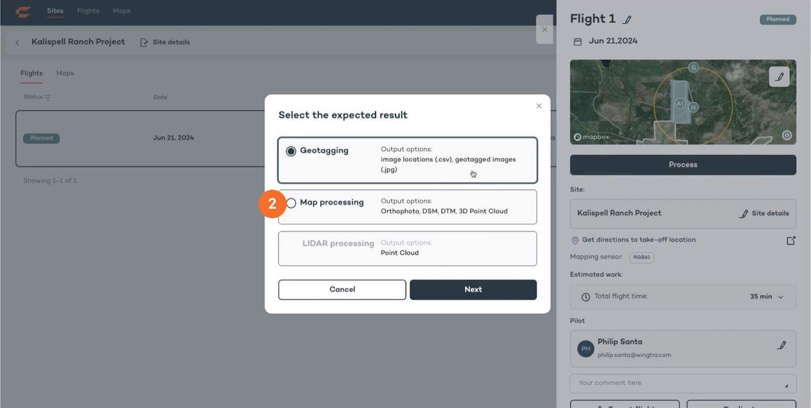
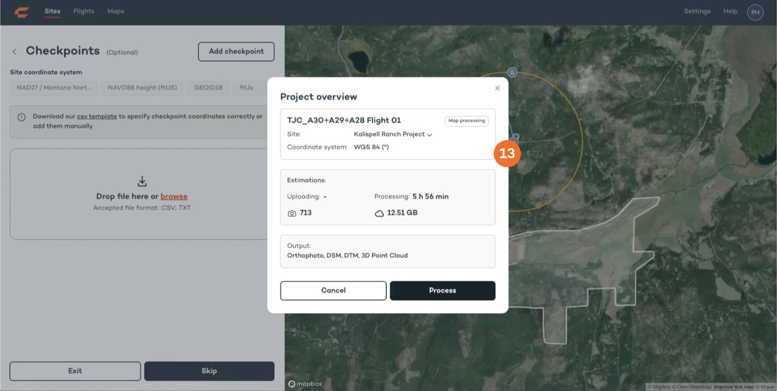
1. Navigate to your flight and click “Process”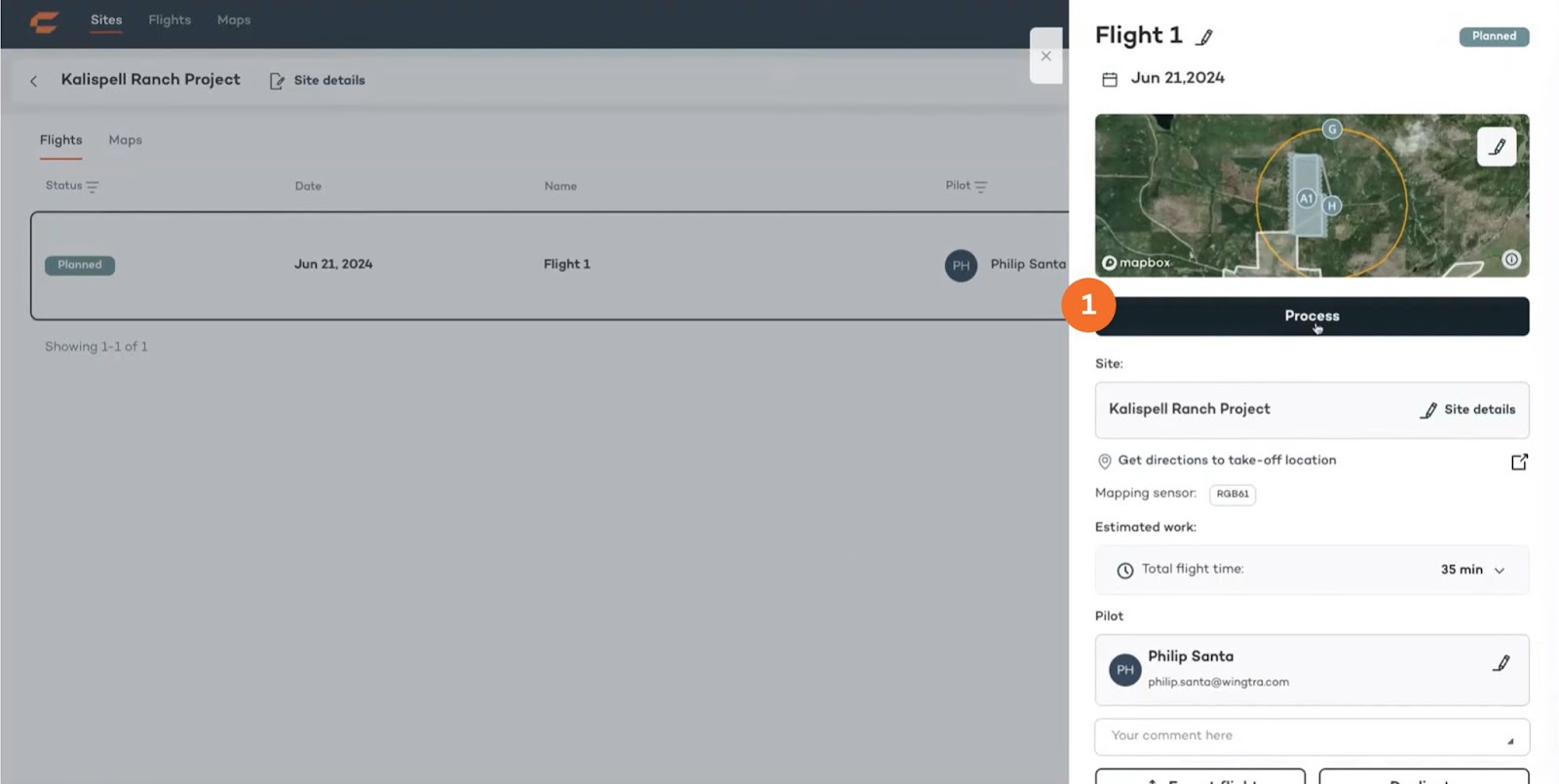
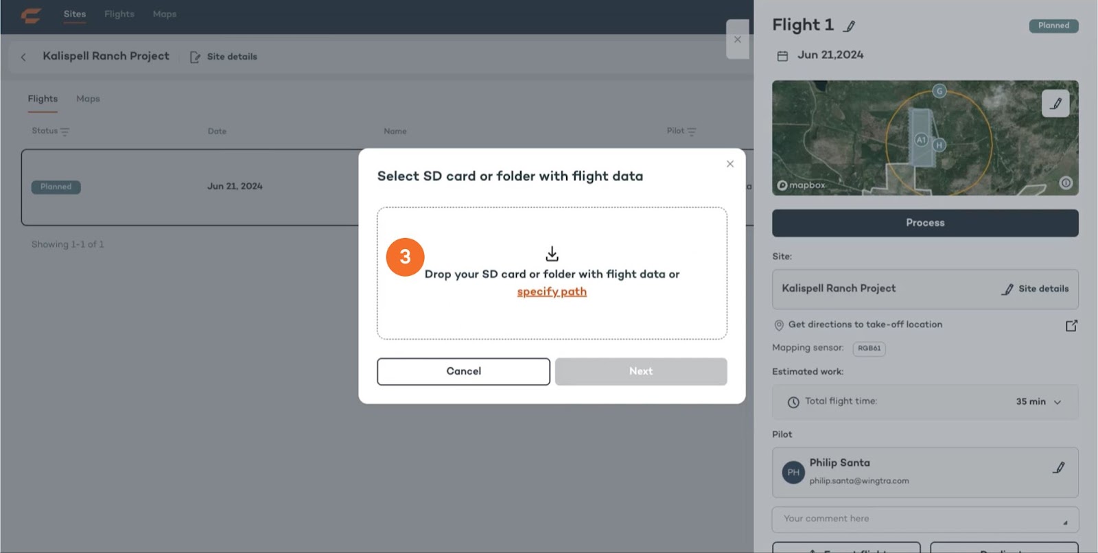
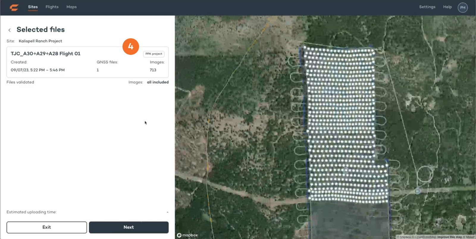
3. Take the SD card out of the camera inside the drone and insert it into your computer. Drop the entire folder of the SD card to let WingtraCLOUD find your flight.
Note: If you have multiple flights a dialog will appear that lets you select which flights you want to process now.
5. a. If you want to work with base station data, drop it to upload.
b. If you don’t want to work with base station data, select “None”.
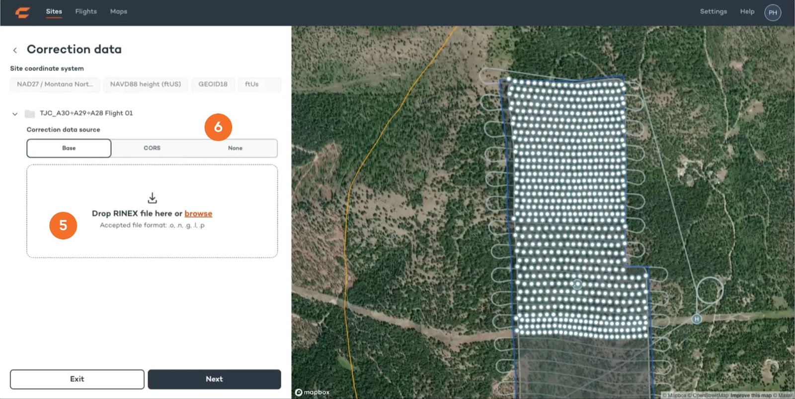
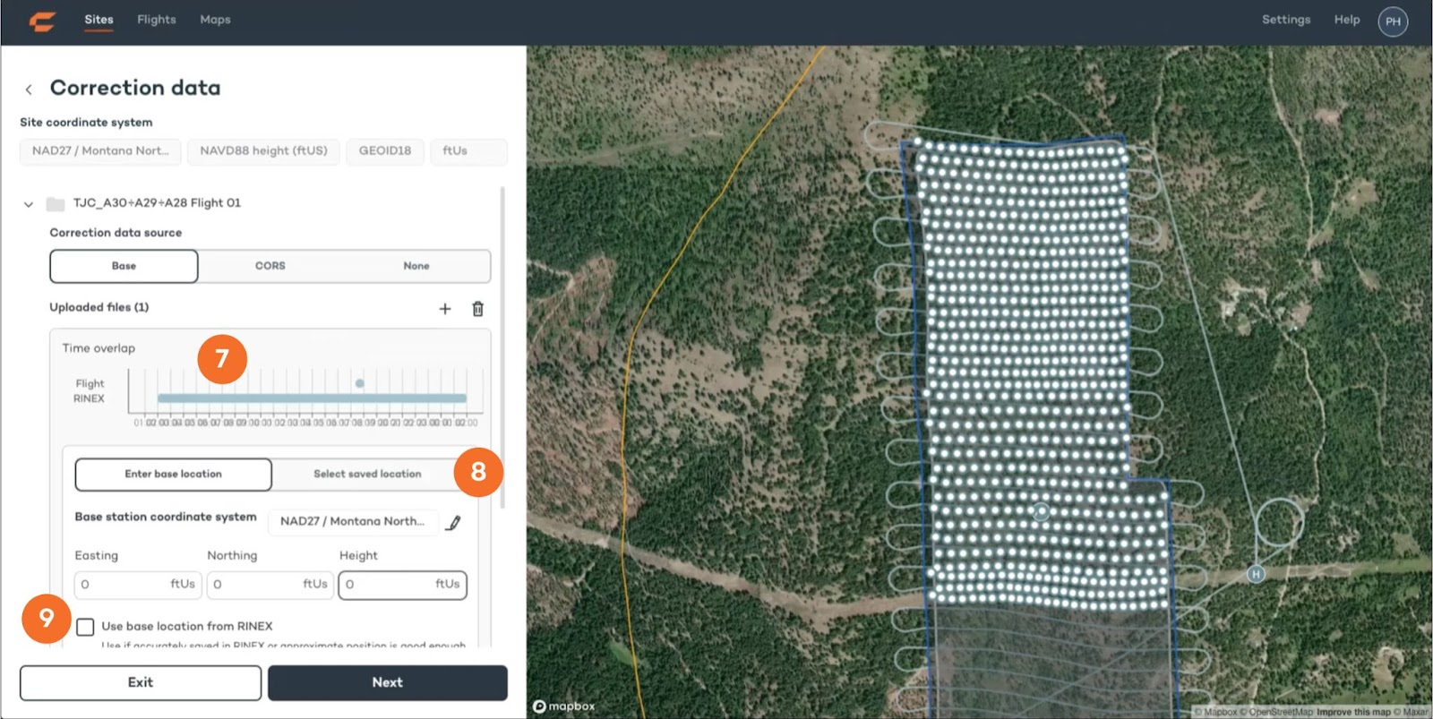
6. Once a base station file has been uploaded you can see the time overlap with your flight data.
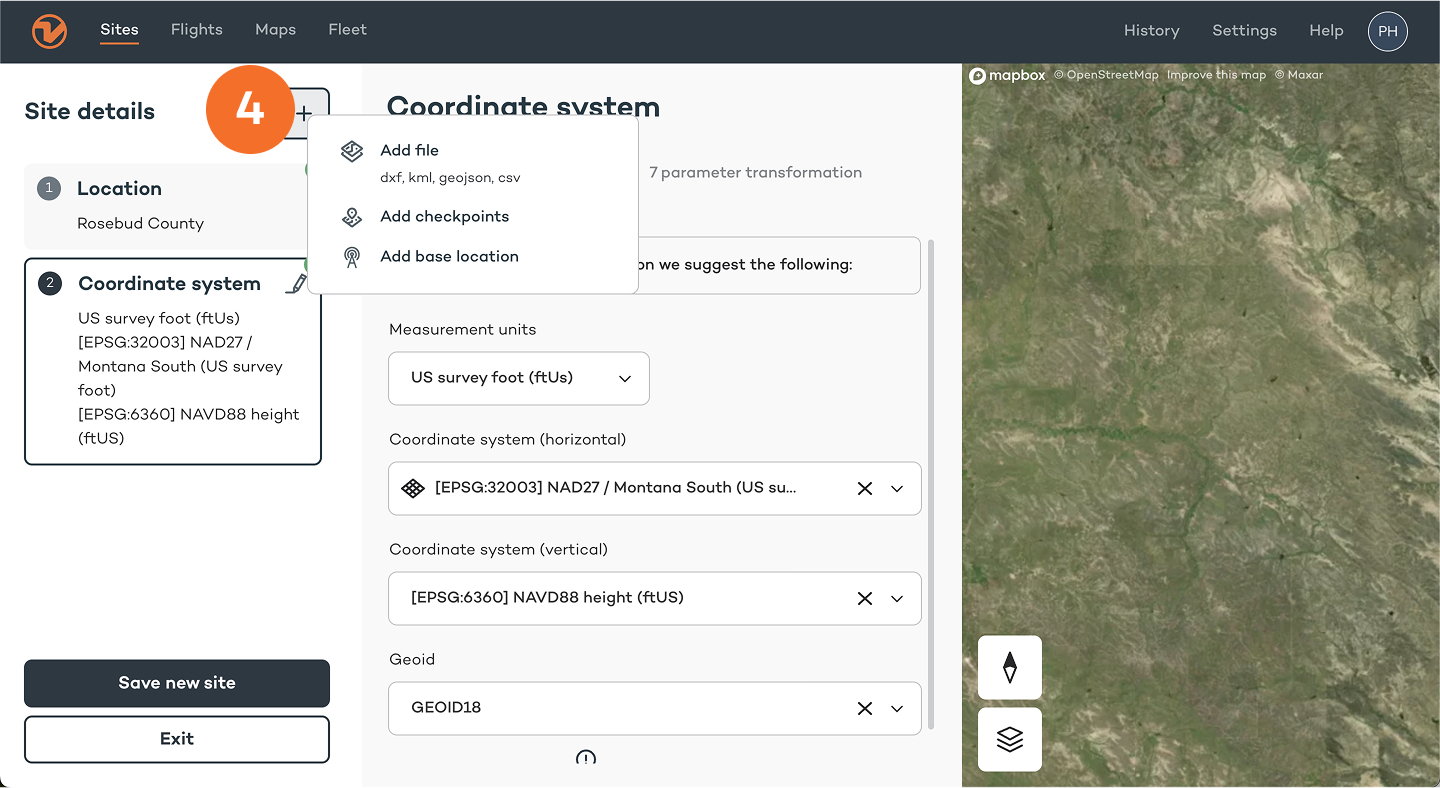
7. Enter the base station location or choose from your saved locations. Make sure that the coordinate system for your base is correct.
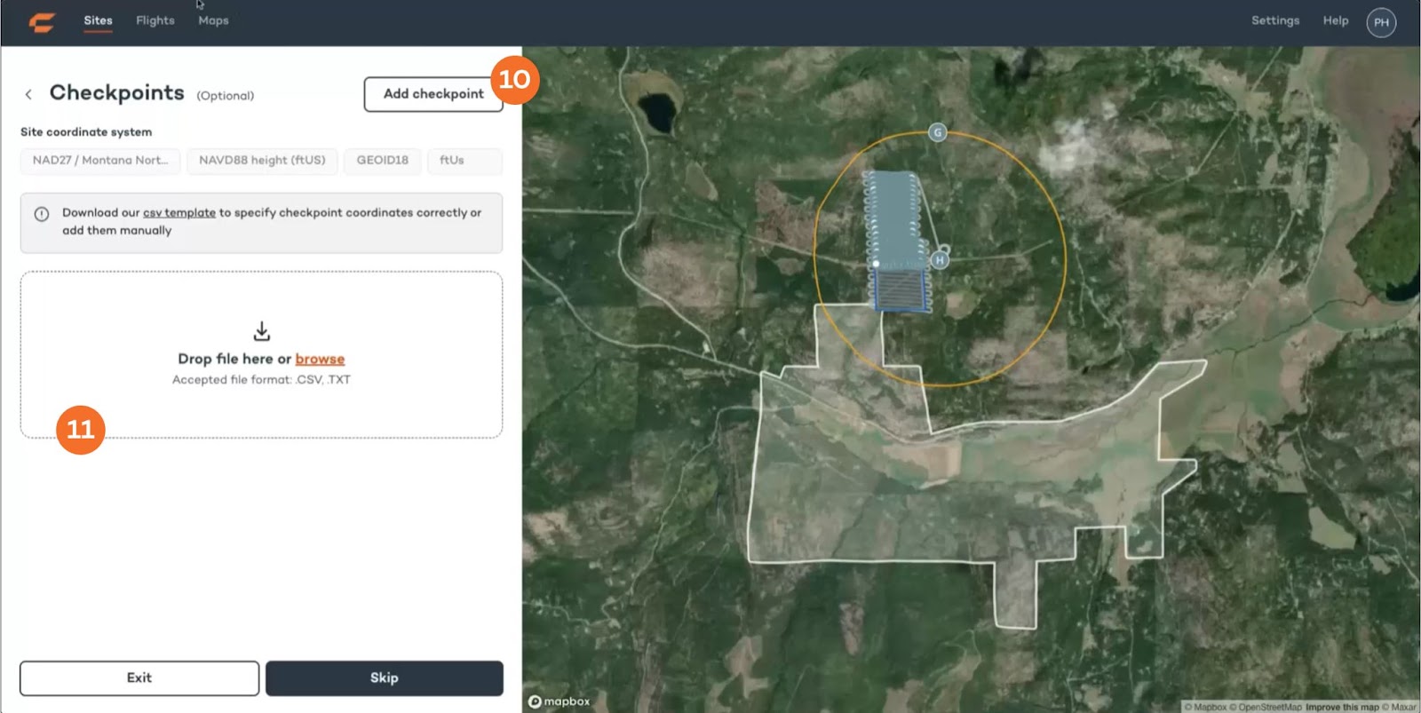
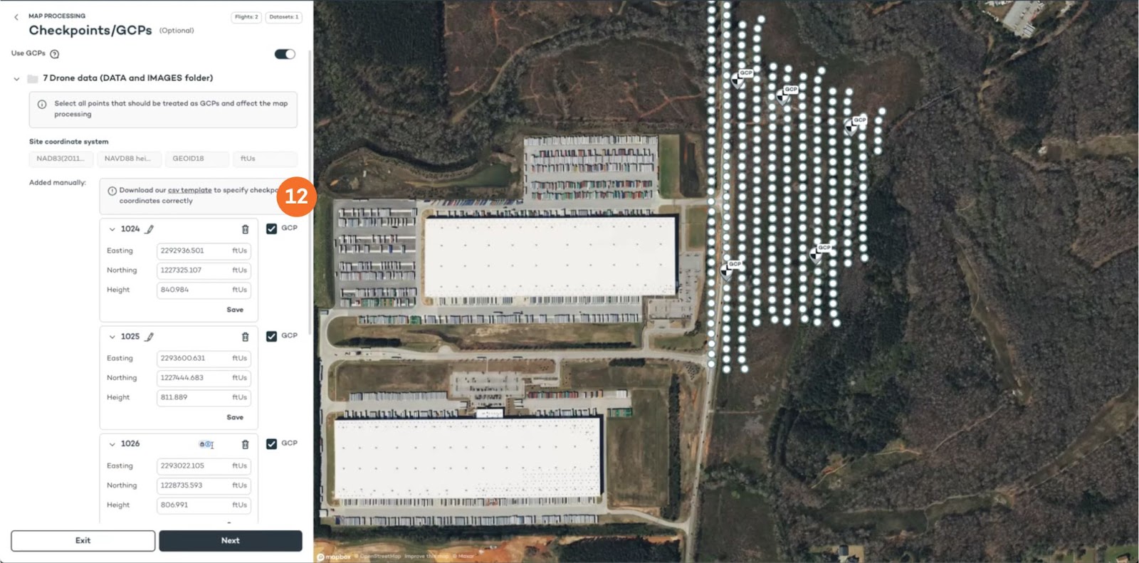
10. Only for map processing: Add checkpoints by uploading a CSV (use the provided template)
If you’re flying a Wingtra LIDAR mapping sensor, find all the information you need here: https://knowledge.wingtra.com/en/lidar-general-setup
7. Analyze your data
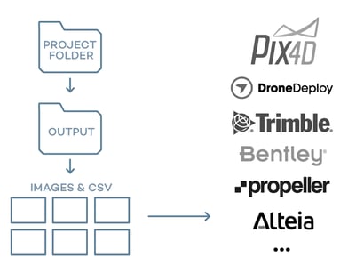
Option 1: Use a 3rd party photogrammetry software and use your geotagging outputs
Data captured with your Wingtra drone is compatible with all major post-processing tools. Prepare it as follows, and start analyzing:
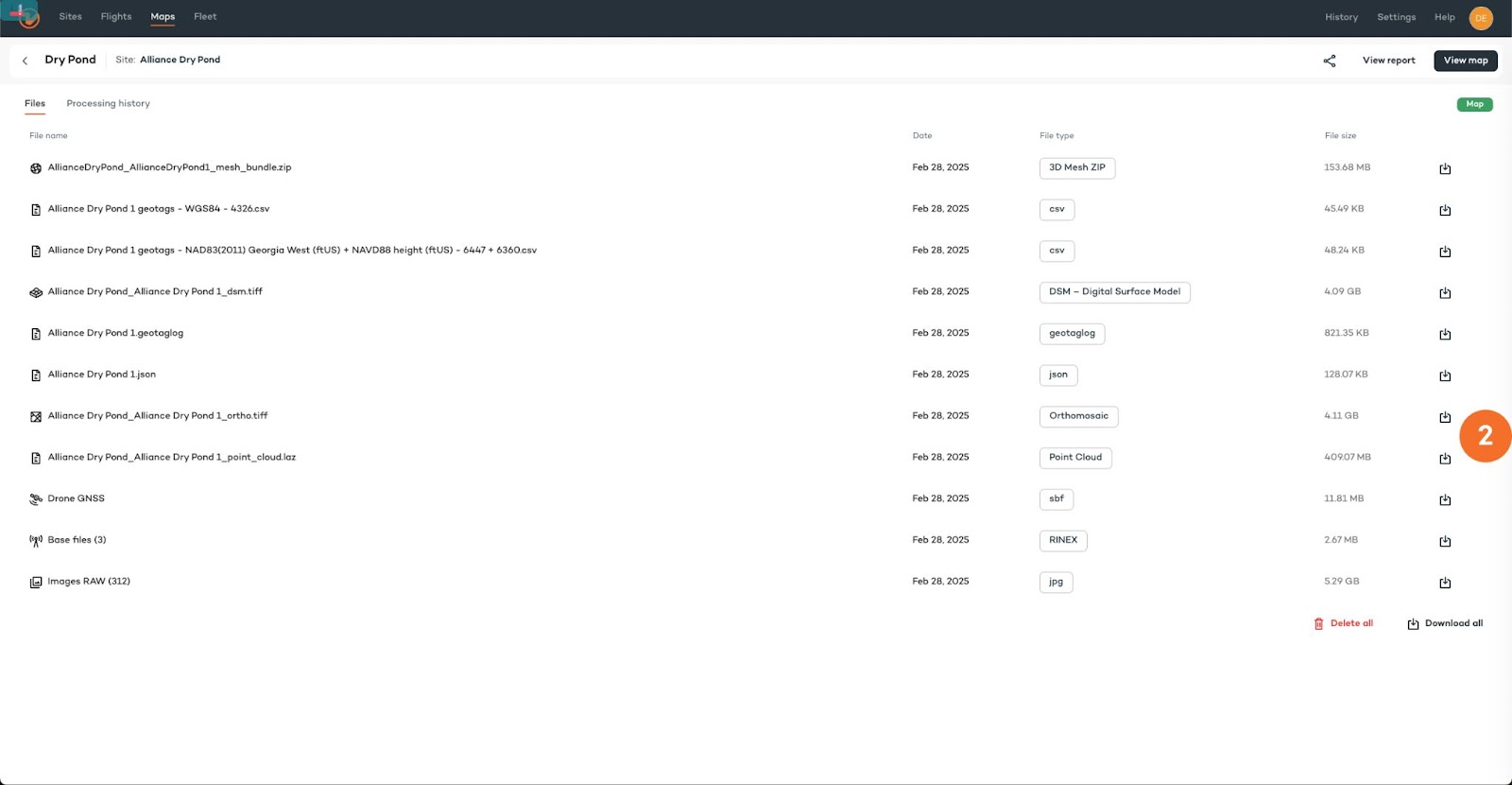
1. Go to the “Maps” tab and open your geotagged flight. In the side bar click on “View files”.

Option 2: Export your maps to other software tools (full resolution)
1. Go to the “Maps” tab and open your map. In the side bar click on “View files”.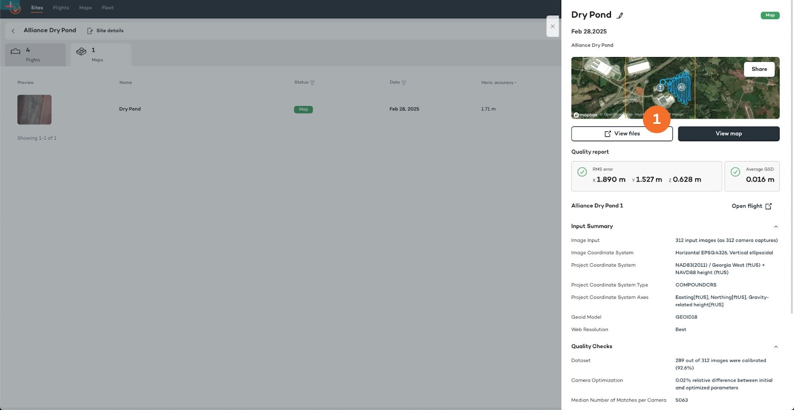
For Wingtra LIDAR data, please refer to https://knowledge.wingtra.com/en/lidar-general-setup
Option 3: Export your maps to other software tools (cropped and downsampled)
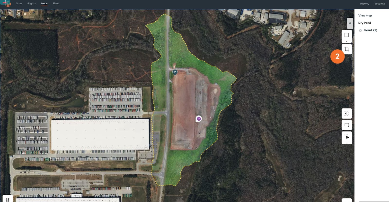
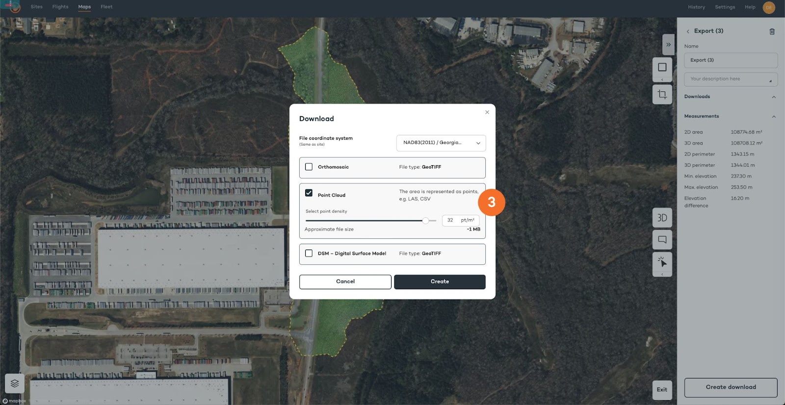
1. Go to the “Maps” tab and open your map. In the side bar click on “View map”.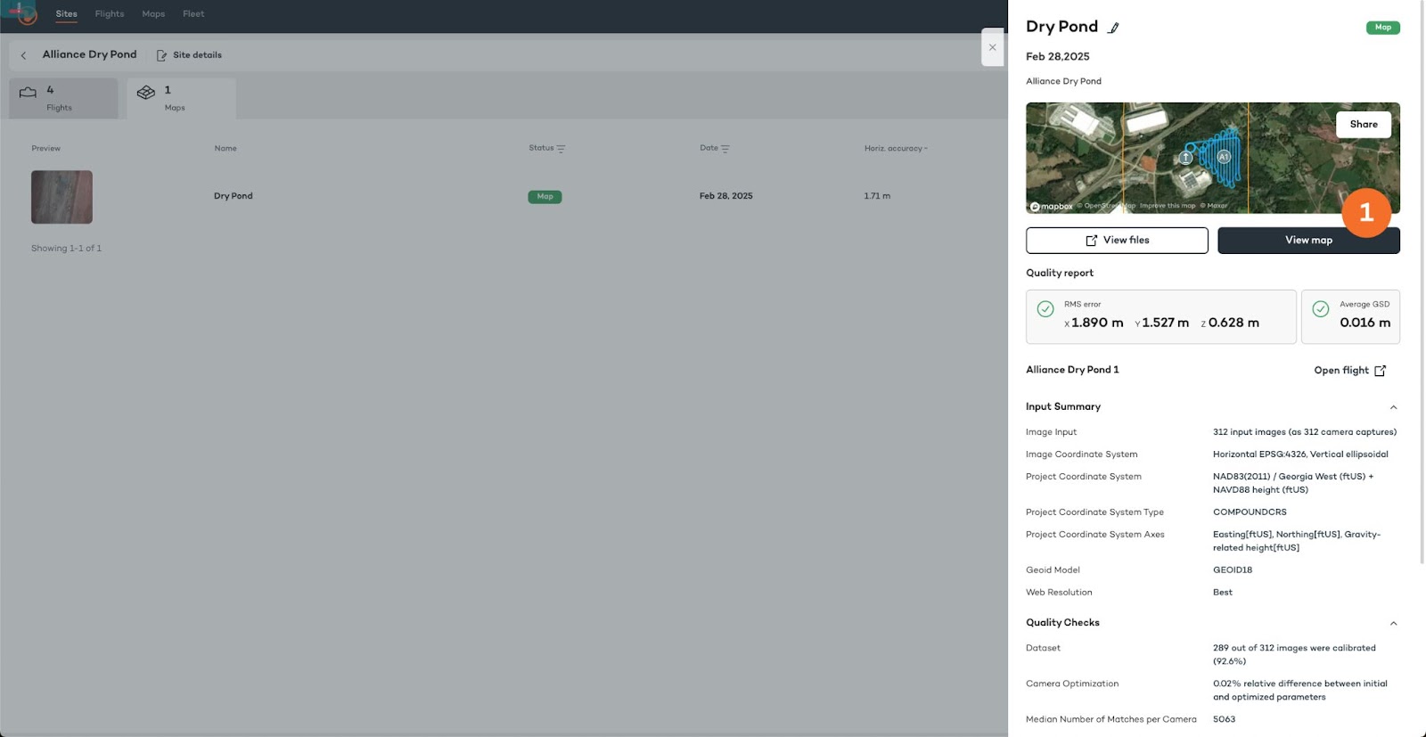
You are good to go! Thank you for using WingtraRAY in your surveying operations.
Contact us at support@wingtra.com if you have any questions.