
To geotag your collected data
- Install WingtraHub on your computer; find instructions at knowledge.wingtra.com
- Take the SD card out of the camera inside the drone and copy the WingtraPilotProjects folder to your computer
- Open WingtraHub
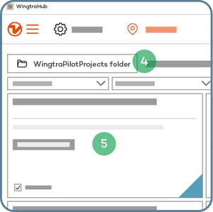
- Open the WingtraPilotProjects folder
- Select the projects you want to process and press "Next"
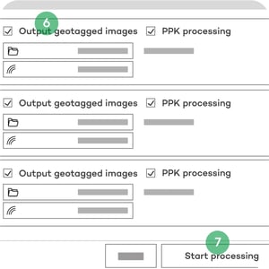
- Tick the “Output geotagged images” box to generate a copy of the images with EXIF/XMP geotags and untick the option to only output the CSV file. Note that generating the geotagged images requires more processing time and more storage space
- Press "Start processing"
Learn more about geotagging of MicaSense Altum, RedEdge and RedEdge-P data.
If you’re flying a Wingtra LIDAR mapping sensor, find all the information you need here: https://knowledge.wingtra.com/en/lidar-general-setup
Optional for PPK data geotagging:
Add "Base file(s)" from your computer—select all available RINEX files.
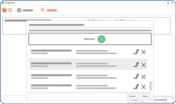
Then add "Base location" as follows:
- Select "Add new"
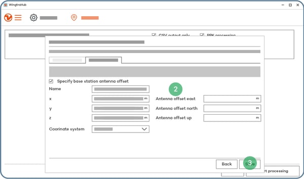
- Enter the coordinates of the base and give a descriptive name
- Select "Save"
- Select "Select"
>>> Next step: 8. Analyze your data
<<< Previous step: 6. During the flight