
Load your data on a photogrammetry software
Data captured with WingtraOne is compatible with all major post-processing tools. Prepare it as follows, and start analyzing:
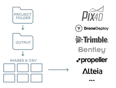
- Once the geotagging in WingtraHub is finished, locate your results in the WingtraPilotProjects folder on your computer's file explorer
- Navigate to the folder "ProjectName"
- Locate the "OUTPUT" folder
- From there, upload the images and the CSV files to your preferred photogrammetry software
For Wingtra LIDAR data, please refer to https://knowledge.wingtra.com/en/lidar-general-setup
You are good to go! Thank you for using WingtraOne in your surveying operations.
Contact us at support@wingtra.com if you have any questions.
>>> Next step: 9. How to activate a Wingtra Extended Service Licence