Aerial data collected with the WingtraOne drone is compatible with major post-processing tools. This means that these output images once geotagged with WingtraHub can be used with any post-processing and mapping software of your choice. The best photogrammetry software for you depends largely on your mapping application and desired output.
We have tested each of the platforms listed below and can stand behind their robust data processing and analysis functionality.
|
RGB nadir |
|
|
PIX4Dmapper Platform: Desktop PIX4Dmapper is the industry-leading photogrammetry software for professional mapping applications and is recommended for the WingtraOne. Excellent for
More info about Pix4D |
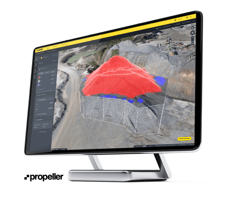
Propeller Platform: Cloud Propeller Aero offers a comprehensive drone data workflow combining innovative Propeller AeroPoints, 3D mapping software, and processing services to simplify the analysis of survey-grade data. Excellent for
More info about Propeller |

|
3D oblique |
|
|
Bentley ContextCapture
Platform: Desktop, Cloud ContextCapture is our recommended solution for the creation of digital twins based on 3D mapping with the Oblique Sony a6100 Excellent for
More info about Context Capture |
ESRI SiteScan
Platform: Cloud ESRI SiteScan is an industry-leading end-to-end, cloud-based drone mapping platform, recommended for 3D outputs and offering seamless access toArcGIS for advanced analytic and hosting services. Excellent for
More info about SiteScan |
|
Multispectral |
|
|
Agisoft Metashape Platform: Desktop, Cloud Agisoft Metashape is an industry-leading end-to-end, drone mapping software, recommended for orthomosaic generation and precise point clouds. Excellent for
|
PIX4Dfields Platform: Desktop, Cloud PIX4Dfields is the fastest and easiest software to work with multispectral images, recommended for Environmental Monitoring and Agriculture applications. Excellent for
|


WingtraOne and other compatible photogrammetry software
Learn about WingtraOne data processing with different tools on the Wingtra website or through recorded webinar sessions.
DroneDeploy
Through interactive digital maps and in-depth analysis, DroneDeploy enables customers to perform better, act faster, and make data-informed business decisions. From small businesses to international enterprises, the DroneDeploy platform has proven itself as a leading photogrammetry software provider. It is easy to use through all stages of flight, processing, analytics, and reporting. Plugging in high-end drone data like WingtraOne’s, site managers can make better decisions, and present accurate data with confidence.
Delair.ai
Delair.ai draws from a deep understanding of the disruptive power of drone data. Accordingly, their software aims to tightly integrate this information into workflows that produce accurate, immediate project insights. Paired with WingtraOne, delair.ai joins other recommended photogrammetry software in tapping the large coverage and high accuracy VTOL market.
Trimble Business Center
Trimble Business Center: Processing WingtraOne drone imagery