To assess whether the relative accuracy is good or not, you should take a look in the quality report that is generated by your photogrammetry software.
Search for a figure like this one, in Pix4D, called 2D keypoint matches figure, which indicates how many tie points two images share.
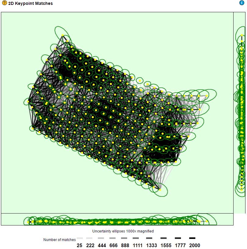
The figure consists of vertices, yellow points that represent each image taken during the flight, and lines between them with intensity that goes from white to black, which indicates the number of matched 2D keypoint between them.
What you are looking for is a dense net of black lines, which means there is a large number of matches between individual images, so the software will be able to generate the outputs with strong relative accuracy without distorsions.
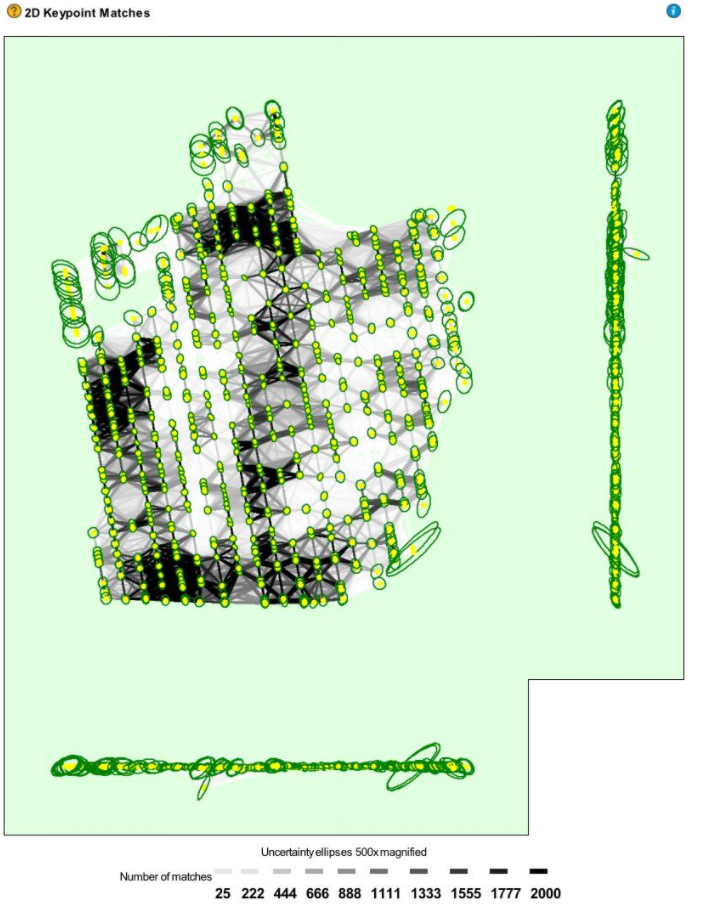
In case the figure looks like the one on the right, this means the relative accuracy is in some parts low, and you should improve it by:
- Adding manual tie points to white areas, which will help the software to improve stitching.
- In case that is not possible, the alternative is to re-fly the mission with different flight parameters such as higher altitude and larger overlaps.
To get a better understanding of the absolute accuracy and precision of your project, you should search for a report like the one below, which is provided in most photogrammetry software. Check the RMS Error and Sigma values.
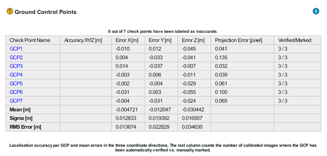
In this example both precision and RMS error are at centimeter level, and that is what you are looking for when doing precise and reliable surveying.
In case values are high please do the following:
- Double check whether the checkpoints are in the same horizontal and vertical coordinate system as the outputs. For more information about WingtraOne PPK coordinate systems check here.
- Check whether the base station is calibrated well in case you ran PPK geotagging, also whether it meets the requirements.
In case you did non-PPK geotagging and you used ground control points, double check whether they are in the same coordinate system as the checkpoints.