When to use high-altitude propellers
- For flights with takeoff altitude below 1500 m (4900 ft) AMSL, you have to use standard propellers.
- For flights with takeoff altitude above 1500 m (4900 ft) AMSL, the use of high-altitude propellers is recommended for all payloads and required for heavy payloads (LIDAR, INSPECT)
- For flights with takeoff altitude above 2500 m (8200 ft) AMSL, the use of high-altitude propellers is required for all payloads.
How high can you fly with high-altitude propellers?
- With high altitude propellers and heavy payloads (LIDAR, INSPECT), you can take off up to 3500 m (11500 ft) AMSL and fly up to 3650 m (12000 ft) AMSL
- With high altitude propellers and light payloads (MAP61, SURVEY61, SURVEY24, A6100, Oblique A6100, RedEdge-P), you can take off up to 4800 m (15.700 ft) AMSL and fly up to 5000 m (16400 ft) AMSL
What are high-altitude propellers?
High-altitude propellers are optimized for the thin air of high altitudes (1500 to 5000 m). They come in pairs and are mounted as replacements to normal propellers, using the same washers and nuts. For step-by-step instructions on how to replace the propellers, read the article Replace the propellers.
You can differentiate between normal and high-altitude propellers by the color of the propellers:
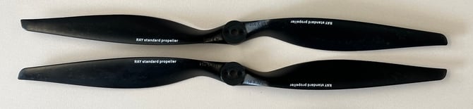
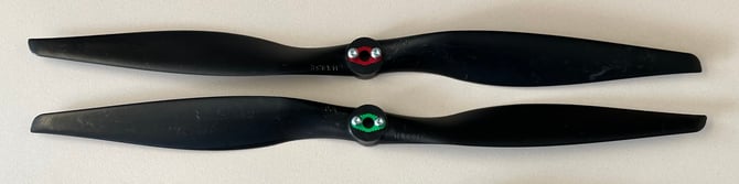
The standard propellers are black:
WingtraRAY standard propellers (14x8.5 E/EP):
WingtraOne standard propellers (14x10 E/EP):
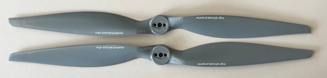
The high altitude propellers (15.7 E/EP) are identical for WingtraOne and WingtraRAY and are grey:
The labels (WingtraOne standard propeller, RAY standard propeller, High altitude propeller) are only available since October 2025.
Low battery RTH and altitude above mean sea level
Automatic low-battery RTH ensures that Wingtra drones always have enough battery capacity to land safely.
Air density decreases as the altitude above mean sea level increases. Therefore, the automatic low-battery RTH is also impacted in higher altitudes, as lower air density means that WingtraOne motors need more power to generate the thrust required to fly. Increased engine power causes increased battery consumption.
When flying at high altitudes, you should expect the RTH to be triggered at higher percentages (up to 60% remaining battery). This percentage is highly dependent on the altitude itself, the transition height, and the distance between the home location and the mapped area.
To ensure maximal flight time at a given altitude please make sure of the following:
- The Transition height is as low as possible (How transition height impacts flight time)
- The survey is as close as possible to the take-off location both in distance to the survey area (visual line of sight) and vertical distance to the survey altitude (not more than 120m above take-off location)
Flight behavior and coverage
Due to the lower air density at higher altitudes, Wingtra drones fly faster with the high-altitude propellers. Although the flight time will be reduced, the drone will still be able to cover large areas. More specifically, you should expect the following decrease in the coverage when flying at high altitudes:
- 2000 m AMSL --> 85% of the area covered at 500 m or 40 minutes of flight time*
- 3000 m AMSL --> 75% of the area covered at 500 m or 33 minutes of flight time*
- 4000 m AMSL --> 60% of the area covered at 500 m or 25 minutes of flight time*
- 5000 m AMSL --> 40% of the area covered at 500 m or 15 minutes of flight time*
* under optimal conditions
More information regarding coverage at 500 m can be found in the Technical specifications.
Another important note: due to the increased flight speed, there are some limitations to the best resolution that can be achieved. The maximum frontal overlap for a given GSD and survey altitude, which ensures that there will not be missing triggers in a flight, is decreasing. Therefore, the lowest resolution that can be achieved in order to successfully map an area increases. More specifically, the lowest resolution that can be achieved with the Sony RX1RII camera at altitudes above 2500 m is 1.0 cm(0.4 in)/ pixel, and with the Sony QX1 camera is 2.5 cm(1 in)/pixel, which correspond to flight height of 78 m (256 ft) and 88 m (289 ft) respectively.