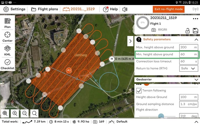
For mapping in difficult terrain, you have options to facilitate path planning. Overall, you will want to enable terrain following in difficult terrain.
Flying above forests or buildings and other manmade objects requires special attention during the flight planning phase to result in a safe flight and to gather good quality data.
Safety of the flight
The elevation/terrain data within WingtraPilot does not account for forests or other obstacles like buildings.

If you want to map a forest or buildings, make sure to set the minimum height above ground to an appropriate value (we recommend normally the height of the tallest building + 30m).

In case the Home point is located close to a building, tree, or other object, make sure that the transition direction is set to the most collision/obstacle free direction.
Data quality
The flight height and overlap are computed based on the elevation data, which refers to the ground. Since the mapped objects lie higher than the ground used in planning, effective GSD is typically better (lower) and overlaps are worse (lower) than planned. Therefore it is recommended to map forests and built areas with higher overlaps. To enhance stitching robustness for such use cases, it is furthermore recommended not to fly very low (use slightly higher GSD than elsewhere).
If you are flying over dense vegetation read this article for more recommendations on optimizing flight planning.