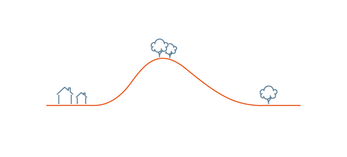
Terrain following allows WingtraOne to adjust the flight altitude for every sweep to achieve a consistent GSD. More specifically, the flight altitude of the individual sweep is defined by the highest terrain point of the sweep. The desired GSD or altitude above ground can be specified as usual. Since the flight height cannot be adjusted along the same flight line, to take advantage of the terrain following feature, you need to fly following the contour lines, which run parallel to a slope or a mountainside.
To achieve terrain following, WingtraPilot uses elevation data from the Mapbox database, which provides global coverage. The elevation data can either be fetched online when planning the mission or cached prior to planning (see Download maps for offline use). Use of the elevation data needs to be enabled when starting WingtraPilot for the first time or later on by clicking the respective option in the WingtraPilot Settings menu. For the safety of operation, usage of elevation data is enabled by default. Alternatively, custom elevation data can be imported and used.
Please be aware that the elevation data is subject to uncertainty and does not account for vegetation, buildings or other objects.
Terrain following can be enabled as a flight parameter. For every area, you can define whether terrain following should be enabled or not. So for flights consisting of multiple areas, terrain following does not need to be enabled for all the individual areas.
Terrain following is enabled by default as it ensures best data quality (uniform GSD and overlaps as set in planning) and makes your flight safer. However, you need to pay extra care in certain situations, e.g. in mines where terrain changes substantially over time, or in cases of steep terrain (slope > 100 percent or 45 degrees).

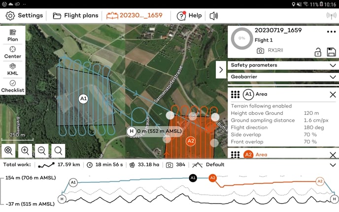
The altitude graph on the bottom allows you to check the flight height in relation to the available terrain data and the minimum and maximum height above ground parameters.